Why Police Departments Are Investing in Advanced Drone Technology
 metaminds
0
2
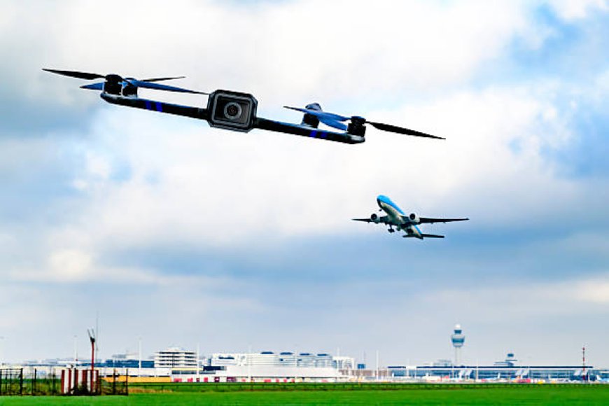
Police work has changed a lot over the last few years. Technology is playing a bigger role in how departments search areas, respond to incidents, and collect information. Police Drones are a good example of that shift. They give officers a way to get an aerial view of a situation without immediately putting another person in the air or sending officers into an area they know very little about. For departments dealing with limited resources, that can be a pretty big deal.
A Faster Way to See What’s Going On
Sometimes the biggest problem for police isn't a lack of people. It's not knowing what's happening.
Take a missing person search. Officers can spend hours walking through fields, woods, or other difficult areas. It takes time, and it's tiring work. A drone can cover a much wider area and give the team on the ground another set of eyes.
And it doesn't always have to be a dramatic situation.
Drones can be useful after a serious traffic accident, during a large public event, or when officers need to check out an area before moving in. Aerial footage can show things that aren't obvious from street level. Roads, buildings, open spaces, vehicles, people moving around. Sometimes that extra bit of information is all an officer needs to make a better decision.
The newer systems are also much more capable than the small consumer drones people may be familiar with. Police departments can use aircraft fitted with high-resolution cameras, thermal imaging, zoom lenses and other equipment designed for professional work.
Thermal cameras are especially useful when visibility is poor. At night, for example, a person hiding in a wooded area might be difficult to spot from the ground. Heat signatures can give officers something else to work with.
It’s not magic. But it can help.
Keeping Officers Out of Unnecessary Danger
There are situations where getting more information before sending officers in makes sense.
A building search is one example. If there is a concern about an armed suspect or an unknown situation inside a property, officers don't necessarily want to walk in without knowing what they're dealing with. A drone may be able to provide an exterior view, identify entrances, or show parts of the property that are difficult to see from the ground.
That information doesn't replace police officers. It just gives them more to work with.
The same goes for difficult terrain. Hills, forests, abandoned properties and large industrial sites can be frustrating to search. Officers still have to do the actual work, but a drone can help point them in the right direction instead of having everyone searching blindly.
There is also the issue of documenting incidents.
Aerial images and video can give investigators a useful record of an accident scene or other event. When collected and handled under the department's policies and applicable laws, that information may be useful later when investigators need to understand what happened.
What Happens to All That Drone Data?
Getting footage is only half the job.
This is where mapping data software can make a difference. A drone may collect a huge amount of imagery during a single operation. Looking through all of it manually isn't exactly the best use of an investigator's afternoon.
Mapping software can turn aerial images into maps, measurements and detailed models of an area. For accident investigations, that could mean having a clearer picture of road layouts, vehicle positions or distances. During a search, it could help teams understand the area they've already covered and where they may need to look next.
It also gives departments a better way to organize information.
Raw video can be useful, but it's not always easy to work with. A properly processed map can sometimes tell the story of a location much more clearly. Investigators can zoom in, compare different areas, take measurements, and refer back to the data later.
The technology is moving pretty quickly, too. Better cameras and faster processing are making it possible to collect and use more information without making the process completely overwhelming.
Drones Can Be Cheaper Than Other Options
Money is another reason departments are looking at drones.
Police helicopters are useful, but they cost a lot to operate. There's the aircraft itself, fuel, maintenance, pilots, storage and training. For a large department, that might be manageable. For a smaller department, not so much.
A professional drone program still costs money. The aircraft aren't free, and departments need trained operators and proper equipment. But compared with running a helicopter, the costs can be much easier to manage.
There's also the issue of availability.
A department with its own drone team doesn't necessarily have to wait for another agency's aircraft to become available. If the situation meets the department's rules for drone deployment, trained personnel can respond directly.
That can be especially useful when an incident is developing quickly.
There Are Some Real Concerns Too
It would be wrong to pretend drone use has no downsides.
Privacy is the obvious concern. People have legitimate questions about when police can use drones, what they can record, how long footage is kept, and who gets access to it.
Those questions shouldn't just be brushed aside because the technology is useful.
Departments need clear policies. Operators need training. There should be rules around when drones can be deployed, how collected information is stored, and when footage can be shared or retained. Depending on the situation and local laws, there may also be requirements around warrants or other legal processes.
Buying an expensive drone and handing it to someone doesn't create a good drone program. There's a lot more to it than that.
Why This Technology Isn't Going Away
The growth of police drone programs isn't really about chasing the latest technology. For most departments, the reason is much more practical.
They want better information. They want to respond faster. And, where possible, they want to keep officers out of situations that could put them at unnecessary risk.
Drones can help with missing-person searches, accident scenes, large events, difficult terrain, disaster response and certain tactical situations. As cameras get better and mapping data software becomes easier to use, those applications will probably continue to grow.
There will still be arguments about privacy and oversight, and there should be. Police technology needs limits just like anything else.
But it's hard to ignore the practical side of it. A drone can get above a scene in a matter of minutes and show officers what's actually there.
It doesn't replace good police work. It doesn't make difficult situations suddenly easy.
It just gives officers another tool, and sometimes another view is exactly what they need.